Showing posts with label LiDAR. Show all posts

26 November 2023

Fountain Bluff 2

 Here some more pics from my short visit to Fountain Bluff yesterday.


Here is a LiDAR image of the area courtesy of IL Elevation Finder (illinois.gov):


06 March 2023

Instructions to get AT Map data and LiDAR for Massachusetts

Instructions to get AT Map data and LiDAR for Massachusetts

First open your browser to

https://nps.maps.arcgis.com/apps/webappviewer/index.html?id=cea61820e75c4ce997f866eea3aaf5b3

And after acknowledging the disclaimer, zoom into Massachusetts.  It will look something like this.


To add information for the trail, click on the 3 horizontal bars in upper right to get this view.


Click on the features you want like shelters, AT Boundary Sections and AT Lands.  At this point specific boundary data and monuments are not found.  I am still trying to figure that out, since that data needs to either be on your computer OR accessible via the web, but you need “permission” to get that.

Now is the LiDAR part.  So far, I have only been able to link Massachusetts, Vermont and Maine LiDAR data, but I am still searching for the states.  To add these data, click on the “plus” sign box in upper left of screen to get this window.


And search for MassGis lidar.  And then add “Shaded Relief from LiDAR (Tile Service) Map Service by MassGIS” to reveal Webster Road for this example.


Not bad for a simple approach.

15 October 2022

Camping out in the AT Berkshires (Tuesday 15 October 1974)

 On the 15th of October 1974. I was hiking on the AT south.  I camped out some 3 miles south of Dalton.  As I recall it was a cloudy day.


This is the historic topo for the area south of Dalton, so I camped out somewhere here.


And this map of my hike into Warner Hill area more recently.  I tried the AT on one trip but after climbing Warner Hill, I saw a fairly steep descent into the former homestead.  On the next trip I followed the old wood road into the settlement.


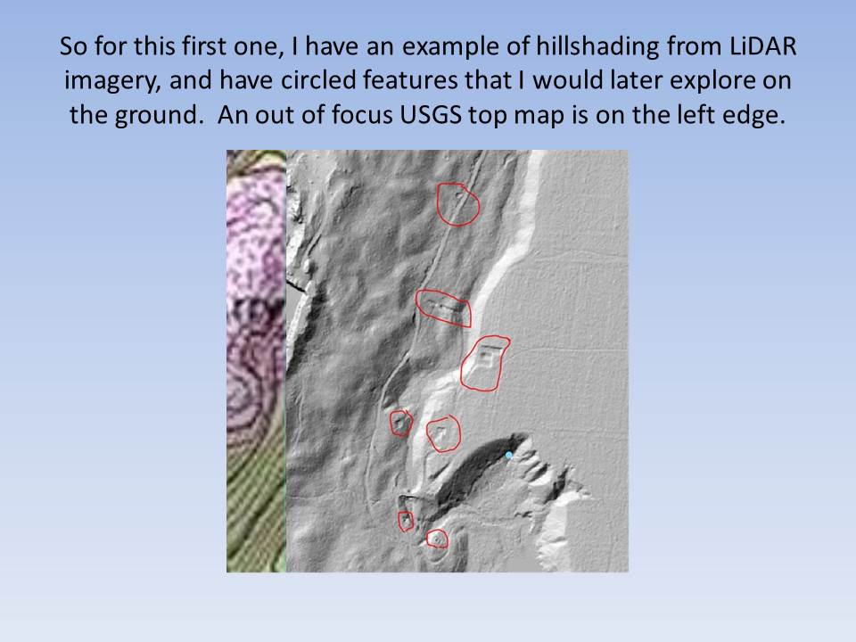
Notice the foundations on this LiDAR image on the AT corridor.


And some details here, showing stone walls, and foundations of the 19th century farm.  Blue lines represent the NPS boundary while the red (even chopped off) shows the Trail:


Here are some pics of the foundations taken November 2020.


This is a north/south roadway.


You can see this old road from the air photos.


Here is a Mass GIS air photo from 2021 showing cleared Warner Hill (old apple orchard) on left and old wood road on right.


So, next time you want to virtually explore an area, try Google Earth with historic imagery and topo maps.

LiDAR maps are a bit more difficult to find so search "LiDAR viewer" and "location" to see what might be available.  The imagery varies by location, availability and quality.


30 November 2020

Warner Hill (part two)

Back on the 9th of November, I wrote about our short hike up to Warner Hill in Western Mass.  the plan that day had been to explore the old farmstead found north of the summit that I had earlier detected using LiDAR.  Well that exploration didn't happen, but this past weekend we returned to the area and entered the site from an old wood road from the south.

So here are some shots.  this first one shows the bed of the old wood road north of Blotz Road.


The AT corridor Monument (number 8) is on the northern end of the settlement.


Multiple stone walls are found throughout the area.


And some evidence of the farm like a shovel blade stuck in a tree.


Up into the corridor, the mixed forest and stones are shown here.


More debris found at a site of a cellar hole.


Another shot of the old road (found on older USGS topomaps, but not the current ones.


These walls show up on the LiDAR, so I need to search old maps from Massachusetts Archive.


Here is monument 9, and unfortunately I didn't have the boundary map to find number 10, where a sharp turn toward the Northwest is found.  But I was following the road.